
Trnovačko Lake Hiking Guide: Bosnia's Hidden Heart-Shaped Alpine Lake
Perućica is not a rainforest. It's something rarer - a primary forest, ancient and untouched, one of the last of its kind in Europe. No cleared paths, no replanted trees. Just centuries of uninterrupted wild.We didn't find this place. We grew up in it. And now we want to show it to you.
Table of Contents
1. What Is Sutjeska National Park?
2. Trnovačko Lake — The Heart of the Park
3. How to Get There & What to Expect
4. When to Visit
5. Maglić — The Summit Above the Lake Trail Details What to Pack
What Is Sutjeska National Park?
Sutjeska National Park is Bosnia and Herzegovina's oldest and most protected natural area, established in 1962. It spans over 17,500 hectares of untouched wilderness in the southeastern corner of the country, bordering Montenegro. The park holds an extraordinary concentration of Balkan nature — ancient primeval forests, glacial lakes, deep river canyons, and the country's highest mountain peaks. What makes Sutjeska genuinely different from other Balkan national parks is its raw, untouched character. Perućica, one of the last two primeval rainforests remaining in Europe, sits within the park alongside the 70-metre Skakavac waterfall — a separate guided experience on its own. Zelengora mountain on the western edge holds a chain of glacial "eyes." And at the eastern border with Montenegro, beneath the ridge of Maglić (2,386m), sits the jewel of the park: Trnovačko Lake.
Note: Sutjeska National Park charges an entry fee at the gate — 10 BAM / 5 EUR per person. This is collected at the checkpoint on the road from Tjentište toward Prijevor. Have cash ready. The fee goes toward maintaining one of Europe's most pristine protected areas.
Trnovačko Lake — The Heart of the Park
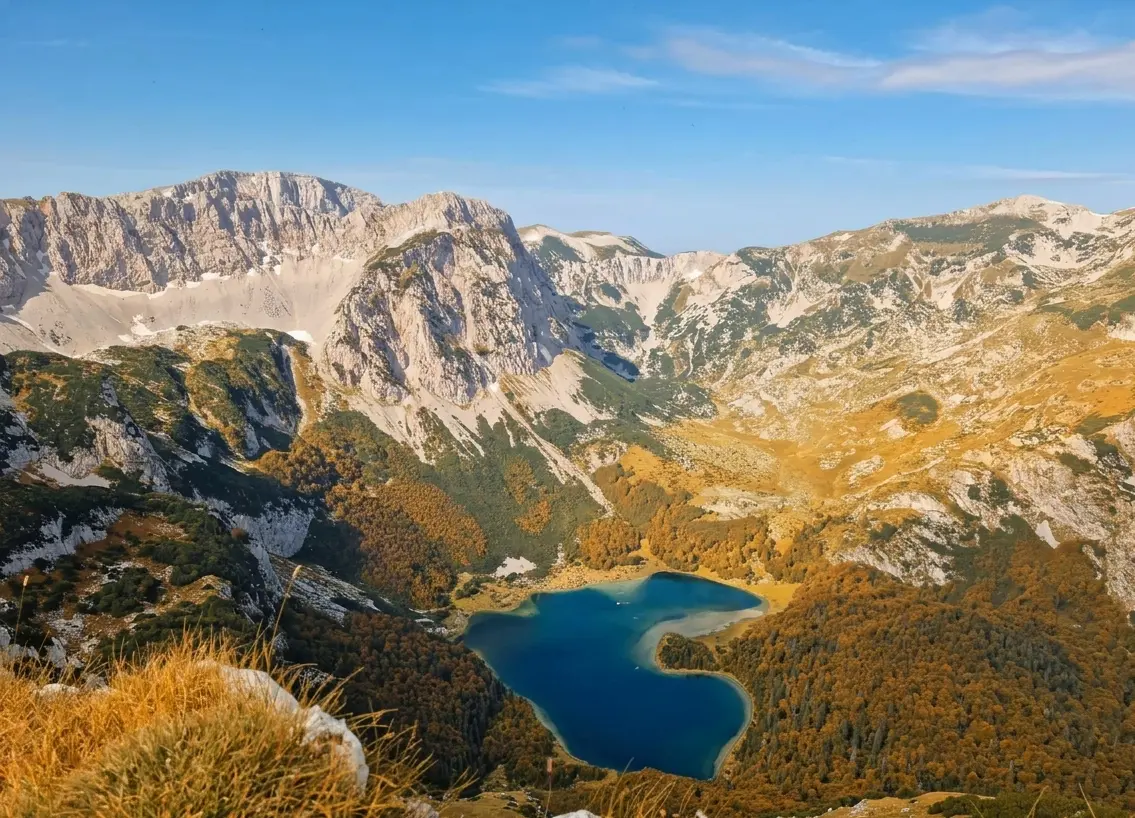
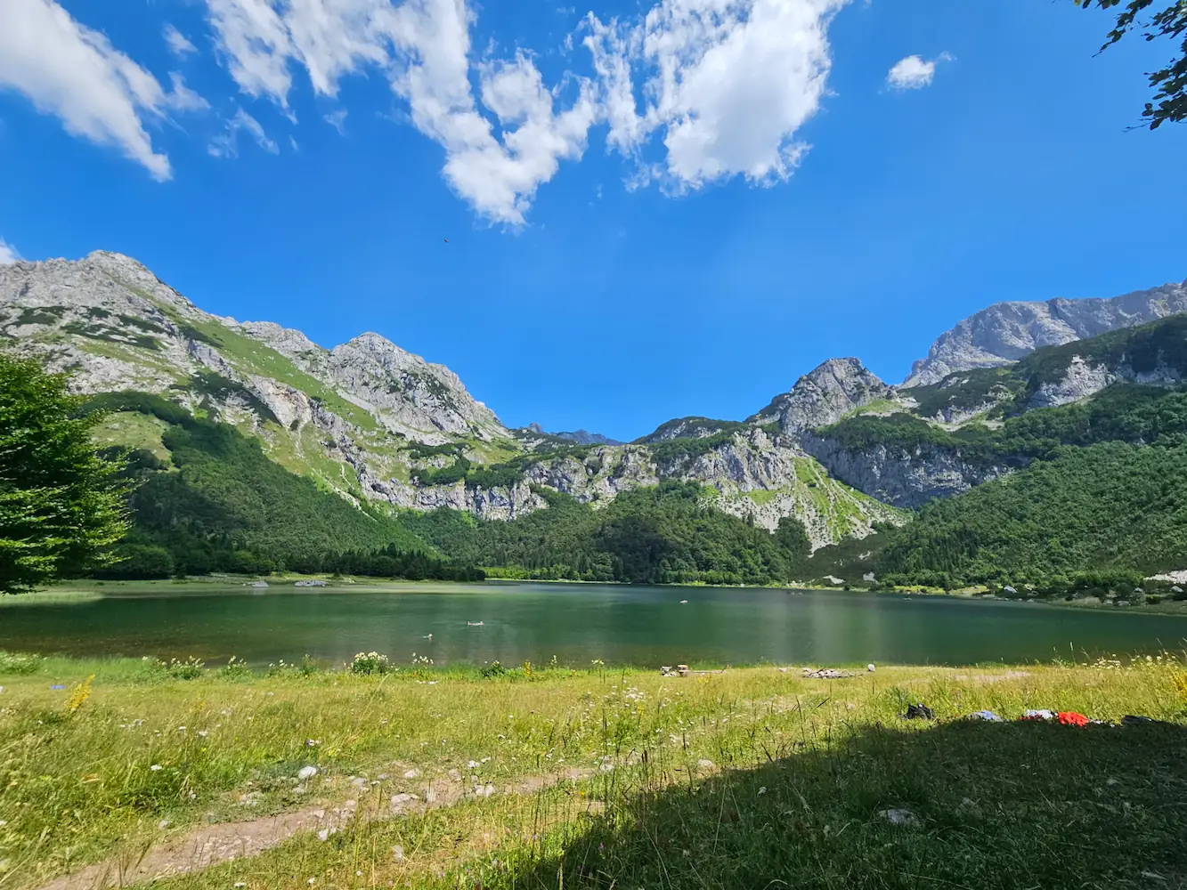
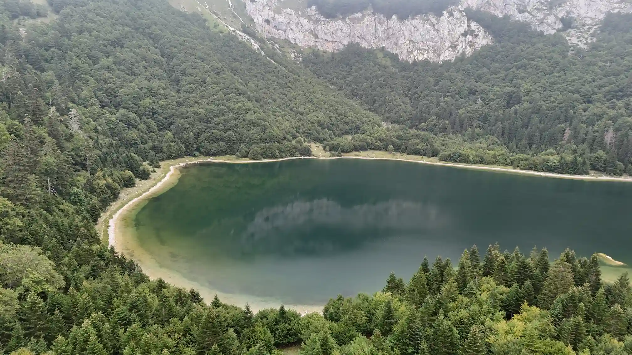
novačko Lake is a glacial lake sitting at 1,517 metres above sea level, right on the border between Bosnia & Herzegovina and Montenegro. It was carved by glacial activity thousands of years ago and left in a near-perfect heart shape — a detail that makes it one of the most photographed natural landmarks on the entire Balkan peninsula. The water is a striking blue-green colour, fed by snowmelt and mountain springs. In July, August, and early September the lake reaches temperatures between 17°C and 20°C+ — warm enough to swim in, which feels almost unreal in such a raw alpine setting. A local ranger is present at the lake during the season, and yes — he sells cold drinks and beers. Few things hit better after a two-hour mountain hike.
How to Get There & What to Expect
The hike to Trnovačko Lake starts from Tjentište, the national park centre, where most visitors base themselves. From Tjentište, you drive approximately one hour to the trailhead at Prijevor saddle — a significant part of the adventure in itself, as the road climbs nearly 1,000 metres in elevation through the heart of the park. Along the way you pass through the national park entry checkpoint, where the entry fee is collected. We strongly recommend hiking with a licensed local guide. The trail is not fully marked at every point, sections cross open ridgelines where conditions can change fast, and a guide brings the landscape to life in ways a GPX track simply cannot. From Prijevor, the trail takes 1.5 to 2 hours one way to reach the lake. The trail itself — what you'll actually walk through: On the way from Prijevor, the trail first passes Špičar — a distinctive rocky outcrop that stands apart from the ridge as you move along the canyon edge. From here, you follow the rim of the canyon with wide open views before the trail begins to descend. You'll pass through Suva Jezerina — literally "Dry Lake" — a wide open depression where a glacial lake once existed. Climate change has dried it completely, leaving a flat, grass-covered basin that is hauntingly beautiful in its own way. This ghost of a lake tells a quiet story about the changes this landscape has seen. From Suva Jezerina the trail continues down through open terrain until you reach the tree line. A short but steeper ascent through forest and rocky ground brings you out above the lake basin — and then you see it. From the moment you step into Montenegro (technically the lake sits on the border), a small entry fee of 1–2 EUR per person is collected by the local ranger.
When to Visit
The optimal hiking window for Trnovačko Lake is June through mid-September. June brings freshly clear trails, vivid green slopes, and manageable crowds. July and August are peak season for good reason — the lake is at its warmest (17–20°C+) and the weather is reliably stable for full-day hikes. September offers arguably the best conditions for photography: golden light, fewer hikers, and the first hints of autumn colour on the ridgelines. October hiking is possible for experienced and well-equipped hikers, but unpredictable early snowfall above 1,500 metres makes it risky. Anything before late May carries a high probability of snow cover on the approach and around the lake basin itself.
Maglić - The Summit Above the Lake
From the shores of Trnovačko Lake, you'll look up and see a massive ridge towering above — that's Maglić, at 2,386 metres the highest peak in Bosnia and Herzegovina. Don't be surprised if the summit is completely hidden in cloud. In fact, that's exactly how the mountain got its name: Maglić comes from magla — the Bosnian word for fog. The summit is frequently wrapped in mist, even on days when the valley below is clear and sunny. It is a mountain that earns its name regularly. For hikers who want to push beyond the lake, the route to Maglić's summit continues from the lake basin up the exposed ridge. It is a serious undertaking — an additional commitment in time, elevation and effort — and is not part of the standard Trnovačko Lake day hike. Most groups on a guided lake tour rest at the water, take a swim, eat lunch, and then return the same way back to Prijevor for the drive back to Tjentište
Trail Details
The trail to Trnovačko Lake follows the same return path — back through the forest, across Suva Jezerina, along the canyon rim past Špičar, and up to Prijevor. Allow the same 1.5 to 2 hours for the return. The terrain feels different on the way back — the ascent through forest after the lake is the most demanding section of the day, so pace yourself on the descent through Suva Jezerina. The return drive from Prijevor to Tjentište takes approximately one hour.
What to Pack
Even in summer, exposed ridgelines above 1,500m can be significantly colder than the valley. Minimum recommended kit for the Trnovačko hike: Sturdy ankle-support hiking boots (no trail runners) Windproof mid-layer or light shell jacket 2.5–3 litres of water (drinks available at lake, but don't count on it) High-calorie snacks and lunch Sunscreen and hat — very little shade on the upper trail Basic first aid and fully charged phone with offline GPX Cash for fees (10 BAM / 5 EUR NP entry + 1–2 EUR lake fee)